Mapping Louisiana: Louisiana Maps from 1513 -1900
Description
The Louisiana Research Collection's renowned map collection extends from 1513 to the present. With more than 400 maps from before 1799, its holdings include state and regional topographic maps, maps of vegetation zones and natural resources, parish and highway maps, and plans of New Orleans tracing the city's development since its founding in 1718. The maps preserve a variety of information ranging from the names and locations of Indian tribes, land owners, plantations, towns, and fortifications, to explorers' routes, depth soundings for the Mississippi River and coastal waters, state and parish boundaries, crops under cultivation, and even the best spots for fishing.
Pages
-

-
Mississippi & Louisiana. Drawn and engraved by J. Bartholomew. Edinburgh, A. & C. Black, 1856.
-
![Mississippi & Louisiana. Edinburgh, Published by A. & C. Black [1873]](/islandora/object/tulane%3A89397/datastream/TN/view)
-
Mississippi & Louisiana. Edinburgh, Published by A. & C. Black [1873]
-

-
Mississippi, Alabama and Louisiana
-

-
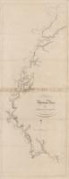
The Mississippi River
-
![[Mississippi River from Dead Man's Bend to Bowie's Pt., Louisiana. Showing land grants and plantations.]](/islandora/object/tulane%3A89405/datastream/TN/view)
-
[Mississippi River from Dead Man's Bend to Bowie's Pt., Louisiana. Showing land grants and plantations.]
-
-
Mississippi River from Iberville to Yazous
-

-
Mississippi River in Louisiana
-

-
Mouth of South Pass showing locations of Jetties proposed by Board of Engineers January 13th 1875. To accompany report of Board of Engineers, Jany 13, 1875. N. Peters, photo-lithographer.
-

-
Mouth of the Mississippi River. Reduced from the Map from Capt. Talcott's Survey made in 1838.
-

-
Neueste karte von Louisiana mit seinen canaeler strassen, eisenbahnen, entfernungen der hauptpunke und routen fur dampfschiffe. Nach den bessten quellen verbessert.
-

-
New and improved Map of Louisiana compiled from the latest and most authentic surveys both public and private. G.W.R. Bayley, Civil Engineer, 1853.
-

-
A new map of Louisiana
-

-
A New Map of Louisiana with its canals, roads & distances from place to place, along the stage & steam boat routes. 1856, Phila.
-

-
A New Map of Louisiana with its canals, roads & distances from place to place, along the stage & steam boat routes. 1856, Phila.
-

-
A new map of Louisiana with its canals, roads, and distance from place to place along the stage and steam boat routes. Philadelphia, Thomas, Cowperthwait & Co., 1850.
-

-
A New map of Louisiana with its canals, roads and distances from place to place, along the stage and steam boat routes
-

-
A new map of Louisiana with its canals, roads and distances from place to place, along the stage and steam boat routes.
-

-
A new map of Louisiana with its canals, roads, and distances from place to place along the stage and steamboat routes. New Orleans inset.
-

-
A New map of North America
-

-
A new map of the Mississippi River from the sea of Bayagoulas
-

-
A new map of the Mississippi River from the sea of Bayagoulas
-

-
A New Map of the North Parts of America claimed by France under the Names of Louisiana, Mississippi, Canada and New France with the Adjoyning Territories of England and Spain
-

-
New Mexico and Florida
-

-
No. 622. No. 2. Page 200. Plan Cushing C. (Pollock). Filed 23 February 1870.
Pages