Mapping Louisiana: Louisiana Maps from 1513 -1900
Description
The Louisiana Research Collection's renowned map collection extends from 1513 to the present. With more than 400 maps from before 1799, its holdings include state and regional topographic maps, maps of vegetation zones and natural resources, parish and highway maps, and plans of New Orleans tracing the city's development since its founding in 1718. The maps preserve a variety of information ranging from the names and locations of Indian tribes, land owners, plantations, towns, and fortifications, to explorers' routes, depth soundings for the Mississippi River and coastal waters, state and parish boundaries, crops under cultivation, and even the best spots for fishing.
Pages
-

-
Hydrographical & Topographical Map of Parts of the States of Louisiana, Mississippi & Alabama compiled from the U.S. Coast surveys. The Topography from Plats on file in the General Land Office. Published by Messrs.. Holle & Co. Exchange Alley. N. Orleans.
-

-
Imaginary Map showing effects of natural action on the Mississippi, Red and Atchafalaya Rivers if not counteracted. E.H. Angamar, C.E. Prepared by A.F. Wrotnowski, C.E. to accompany special report of Board of State Engineers, 1874. Plate V.
-

-
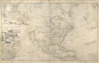
The Isle of California, New Mexico, Louisiana, The River Mississippi and the Lakes of Canada
-

-
Johnson's Arkansas, Mississippi and Louisiana. Johnson and Ward, 1860? 1864?
-

-
Johnson's Arkansas, Mississippi and Louisiana. Johnson and Ward, 1864.
-

-
Johnson's Arkansas, Mississippi and Louisiana. Johnson and Ward, 1864.
-

-
Johnson's Arkansas, Mississippi and Louisiana. Johnson and Ward, 1864.
-

-
Karte von Nord Amerika vom 50sten Grade derBreite bis gegen den Wendekriets des Krebses, nach den neusten Angaben
-

-
L' Ancien et le Nouveau Mexique avec la Floride et la Basse Louisiane partie orientale par M. Bonne
-

-
La Louisiane et Pays Voisins
-

-
La Louisiane Route of de Soto and Moscoso
-

-
La Luisiana cedida al Rei N. S. Por S. M. Christianisma, con la Nueuva Orleans, e Isla en que se hall esta Ciudad
-

-
Le nouveau Mexique avec la partie septentrionale de l'ancien ou de la nouvelle espange
-

-
Les Etats-Unis de l'Amerique Septentrionale, contenant en outre, les Isles Royales, de Terre neuve de St. Jean et l'Acadie; avec partie du Canada, de la Louisiane et de la Floridae
-

-
Les Etats Unis de l'Amerique Septentrionale partie occidentale
-
-
Lord John Summers Map of North America
-

-
Louisiana
-

-
Louisiana
-

-
Louisiana
-

-
Louisiana
-

-
Louisiana
-

-
Louisiana
-

-
Louisiana
-

-
Louisiana
Pages